

The Camino Frances in 34 Days: A Camino de Santiago Itinerary
One of the wonderful things about the Camino de Santiago is that it does not have a singular itinerary: along the Frances route alone, there are hundreds of towns where pilgrims can stay. You can walk as much or as little as you want each day, and complete the Camino in as many days as it takes at the pace that’s right for you.
However, most people tend to walk the full Camino Frances (from Saint-Jean-Pied-de-Port, France to Santiago de Compostela, Spain) in about 30 to 35 days. In 2023, I walked the Camino Frances in 34 days.
In this post, I’ll give you my exact 34-day Camino Frances itinerary — but tweaked a bit to correct a few mistakes I made. If you have 33 to 35 days to walk the Camino, this is an itinerary I recommend. (I’ll tell you what to do if you have only 33 days, and where you can slow things down a bit if you want to take 35 days!) Use this post to guide you as you plan your own Camino!
Want to read more about the Camino?
Find my complete travel guide for the Camino de Santiago here.
This post contains affiliate links. If you make a purchase or a booking through one of these links, I may receive a small commission at no extra cost to you. Thanks for supporting In Old Cities in this way!
Camino Frances in 34 Days | Itinerary at a Glance
Don’t have time to read all the details? Here’s a quick overview of my recommended Camino Frances itinerary.
| DAY | BEGIN | END | DISTANCE |
|---|---|---|---|
| 1 | Saint-Jean-Pied-de-Port | Roncesvalles | 25 km / 15.5 mi |
| 2 | Roncesvalles | Zubiri | 22.3 km / 13.9 mi |
| 3 | Zubiri | Pamplona | 21.1 km / 13.1 mi |
| 4 | Pamplona | Puente La Reina | 24 km / 15 mi |
| 5 | Puente La Reina | Estella | 21.5 km / 13.3 mi |
| 6 | Estella | Los Arcos | 21.3 km / 13.2 mi |
| 7 | Los Arcos | Logroño | 28 km / 17.4 mi |
| 8 | Logroño | Nájera | 30.5 km / 19 mi |
| 9 | Nájera | Santo Domingo de la Calzada | 21.7 km / 13.5 mi |
| 10 | Santo Domingo de la Calzada | Belorado | 22.9 km / 14.2 mi |
| 11 | Belorado | Agés | 27.7 km / 17.2 mi |
| 12 | Agés | Burgos | 22.3 km / 13.9 mi |
| 13 | Burgos | Hornillos del Camino | 22 km / 13.7 mi |
| 14 | Hornillos del Camino | Castrojeriz | 21.4 km / 13.3 mi |
| 15 | Castrojeriz | Frómista | 26.7 km / 16.6 mi |
| 16 | Frómista | Carrión de los Condes | 20.4 km / 12.7 mi |
| 17 | Carrión de los Condes | Terradillos de los Templarios | 26.3 km / 16.3 mi |
| 18 | Terradillos de los Templarios | Bercianos del Real Camino | 24.5 km / 15.2 mi |
| 19 | Bercianos del Real Camino | Reliegos | 20.8 km / 12.9 mi |
| 20 | Reliegos | León | 25.4 km / 15.8 mi |
| 21 | León | Villar de Mazarife | 22 km / 13.7 mi |
| 22 | Villar de Mazarife | Astorga | 31.5 km / 19.6 mi |
| 23 | Astorga | Foncebadón | 26 km / 16.1 mi |
| 24 | Foncebadón | Ponferrada | 27.2 km / 16.9 mi |
| 25 | Ponferrada | Villafranca del Bierzo | 24.3 km / 15.1 mi |
| 26 | Villafranca del Bierzo | La Faba | 23.7 km / 14.7 mi |
| 27 | La Faba | Triacastela | 25.8 km / 16 mi |
| 28 | Triacastela | Samos | 10.4 km / 6.5 mi |
| 29 | Samos | Sarria | 14.6 km / 9.1 mi |
| 30 | Sarria | Portomarín | 22.6 km / 14.1 mi |
| 31 | Portomarín | Palas de Rei | 25.8 km / 16 mi |
| 32 | Palas de Rei | Ribadiso da Baixo | 25.8 km / 16 mi |
| 33 | Ribadiso da Baixo | O Pedrouzo | 22.2 km / 13.8 mi |
| 34 | O Pedrouzo | Santiago de Compostela | 20 km / 12.5 mi |
Camino Frances 34-Day Itinerary | Day-by-Day Details
Here’s where I dig into the nitty gritty details of my 34-day Camino itinerary. I’ll give you the distance and difficulty of each day’s route (including a notable challenge from each day), describe what you can expect as you walk, and tell you where I stayed for the night (and whether I recommend it!).
Day 1: Saint-Jean-Pied-de-Port to Roncesvalles
Distance
25 kilometers
15.5 miles
DIFFICULTY
3/3
mountainous
The first day of the Camino Frances is also the most difficult, as you’ll cross the Pyrenees mountain range and you may or may not be in good shape (yet). The 4600-foot ascent (1400 meters) is challenging, to say the least, and the descent (2100 feet, or 650 meters) is not easy either.
However, if the weather is good, it’s also one of the most beautiful days of the whole Camino Frances, with sweeping mountain views most of the day.
The steepest and most difficult section of the day is early on, just a few miles outside of Saint-Jean-Pied-de-Port (with a long series of steep switchbacks). Accordingly, many pilgrims choose not to go the whole way to Roncesvalles on Day 1, and instead stop for the night at the auberge in Orisson, which is about 4.6 miles outside of SJPdP (and just past the steepest switchbacks). The auberge (French hostel for pilgrims — in Spain, they’re called albergues) has a huge deck with wonderful views, and I’m told by friends that pilgrims who stay at Orisson often spend the afternoon chatting and playing cards on the deck.


Book in advance if you want to stay at Orisson, as it often sells out. There is also a new auberge not long after Orisson — Borda — which provides a second option for getting to Roncesvalles in two days rather than one, if that is what you want to do. (I do recommend this for people who have the time, and are unsure if they are fit enough to reach Roncesvalles in one day!) Two of my friends stayed at Borda and said it is wonderful.
If you do not stay at Orisson or Borda, and continue on to Roncesvalles, I still recommend taking a break at Orisson. Consider buying a sandwich to take with you for later — during the warm seasons, there is also usually a food truck or two along the mountain route, but it’s not a bad idea to carry food through this more remote day of walking.
After Orisson/Borda, the views just get better and better. And while the inclines continue for most of the day, they are generally more gradual from miles 7 to 12 or so.
The highest point of the day is about 12.7 miles from SJPdP. On the day I hiked, a food truck was sitting at the top. I had my first slice of Tarta de Santiago (a Galician almond cake; you will see it everywhere toward the end of the Camino) and enjoyed the feeling of accomplishment.
From the high point, there is a three-way fork. You can walk down via the road, or via either of two trails through the trees. Speaking from experience, I do not recommend the lefthand trail, which is shorter but is extremely steep and rocky. (Plus, someone I met later began her Camino with a friend who broke her ankle on this trail and had to end her Camino early!)

Where I Stayed
Orreaga-Roncesvalles
Like most pilgrims, I stayed at the huge Orreaga-Roncesvalles albergue, which is housed in a monastery complex. This is a classic Camino Frances experience, and I do not recommend staying anywhere else in Roncesvalles unless you have special circumstances (for example, if you need private lodging due to a medical issue). The rooms are clean and the albergue is exceptionally well-organized, but be aware that you will be sleeping in a bunk bed in a room filled with dozens of other bunk beds. (Just go with it! Welcome to the Camino!). I would not expect to get an exceptional night of sleep in Roncesvalles.
NOTE: There are actually two routes from SJPdP to Roncesvalles. The pilgrims’ office in SJPdP will instruct you if one way is safer at the time you are walking. I took the Napoleon route, which may be closed in the winter and bad weather but is otherwise usually recommended over the alternative Valcarlos route.
Day 2: Roncesvalles to Zubiri
Distance
22.3 kilometers
13.9 miles
DIFFICULTY
2/3
steep descent
Day 2 begins with a gorgeous walk through the woods on the way out of Roncesvalles. More woods, plus some small towns and pretty fields with animals, follow for the first half of the day. This part of the path is largely flat and relatively easy.
About 7.5 miles (or 12 kilometers) into this day, you’ll reach Gerendiain — the final town before Zubiri. Here, the path becomes much steeper and tougher. A food truck several miles before Zubiri provides a nice place to take a break.
The last few miles into Zubiri are a long and often steep descent. It’s notoriously rocky and, if there’s been any rain recently, muddy. Hiking poles will do you good here.


Where I Stayed
Suseia
Suseia is a small and wonderful albergue that I recommend completely. The backyard was a lovely place to sit and chat with fellow pilgrims in the afternoon, and the communal meal was perhaps the single best meal I ate on my entire Camino. (The breakfast was great, too!) Do not miss this place!
Day 3: Zubiri to Pamplona
Distance
21.1 kilometers
13.1 miles
DIFFICULTY
1/3
some urban walking
This is an easy, pleasant day of walking. Much of the path goes through woods and is largely along a river, though there is some brief walking along a highway.
In the second half of the day, you make a detour up to the church of Zabaldika. There is a steep but short hike up to the church, where you can get a stamp in your credencial, plus a blessing from volunteers at the church. There is also an albergue beside the church. Assuming that you choose to press on to Pamplona, there is an alternate route down on the other side of the church, which eventually joins back up with the main Camino route. (I thought this section was one of the most beautiful parts of my day; there are great views down the hill and ahead toward Pamplona.)
The last few miles are urban walking on sidewalks. You will approach the city via Pamplona’s massive city walls.
At times on the Camino, a destination calls for a bit of sightseeing, and Pamplona is one such place. The cathedral is worth a visit, and you simply must go out for tapas and cheap wine in the evening!


Where I Stayed
Casa Ibarrola
I liked Casa Ibarrola quite a lot. There is one room for sleeping with quite a few beds, but they are capsule beds of sorts (with partial walls, curtains, and compartments), so it is not hard to get some privacy nonetheless. My only complaint is that (because of the capsule bed situation) pilgrims are required to leave their bags downstairs, in a separate space, which is fine but not as convenient as having your things right beside your bed. (It does make for a quieter room in the morning, though, since people are not packing up in the same place where some pilgrims are still sleeping!)
Day 4: Pamplona to Puente La Reina
Distance
24 kilometers
15 miles
DIFFICULTY
2/3
steep descent
The first few miles of Day 4 are, of course, more urban walking as you gradually exit Pamplona. Eventually, the city and highway walking gives way to fields. Here, the path has some prolonged inclines, but nothing horribly steep.
One of these inclines leads to Zariquiegui, where I recommend stopping for some food. After Zariquiegui, you will begin the walk up Alto del Perdon. Roughly translated, Alto del Perdón means “Hill of Forgiveness.” At least one legend says that pilgrims climb Alto del Perdón to seek forgiveness for their own sins, but like so many things on the Camino, people make of it what they will. The climb is steep but fairly short.
At the top of Alto del Perdón (a narrow ridge with many windmills) is a famous monument depicting a group of pilgrims walking west. Be sure to look back for wonderful views below.
The way down from Alto del Perdón is very, very rocky and steep. When you reach the bottom, there are several miles through fields a few small towns. This is a beautiful stretch, but there is little shade.
Puente La Reina is a lovely little town with a famous arched bridge. You will walk over the bridge on your way out of town the next morning, but I recommend checking it out in the afternoon as well.

Where I Stayed
Estrella Guia
I do recommend Estrella Guia. This is a nice place just around the corner from the bridge. The rooms are fairly small, which means they don’t have a ton of bunks in them (a plus).
Some of my friends stayed at Santiago Apostol, where I joined them for the communal dinner. It’s situated up on a hill, so there are good views, but be warned that the climb up to the albergue is steep.
Day 5: Puente La Reina to Estella
Distance
21.5 kilometers
13.3 miles
DIFFICULTY
2/3
steep hill
On your way out of Puente La Reina, be sure to take a few steps off the path to grab a photo of the bridge — in the early morning, the river is often still, creating opportunities for great photos of the bridge reflecting clearly in the water.
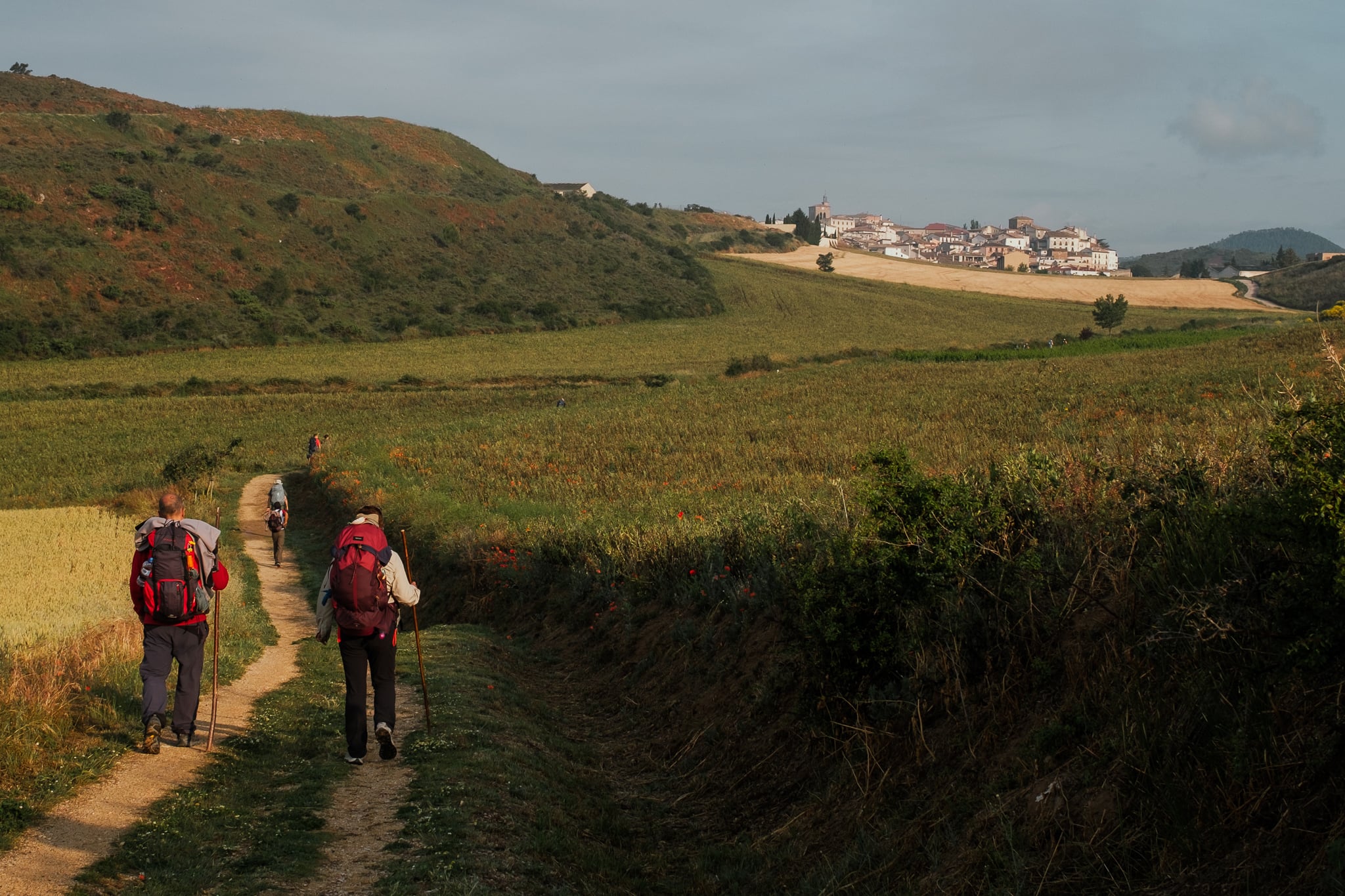
This day has an infamously steep hill just a few miles in. However, the first town of the day (Mañeru) follows shortly thereafter, and the rest of the day is quite beautiful. In fact, the stretch approaching and exiting the hilltop town of Cirauqui was one of my favorite bits of the entire Camino Frances, with beautiful views of the town and vineyards all around.
You’ll also walk some genuine Roman road and cross a Roman bridge between Cirauqui and Lorca. On the whole, this is a gorgeous day with (mostly) manageable inclines.
In my view, Estella is also one of the most charming towns on the Camino Frances; be sure to spend a bit of time walking around and enjoying the many beautiful sights.
Where I Stayed
Hosteria de Curtidores
Hosteria de Curtidores was one of the nicest albergues I stayed in on the entire Camino Frances. It’s also the first albergue in town, which is helpful at the end of a long day of walking (though it does mean walking a bit more if you want to explore the town at all, and you should).
Day 6: Estella to Los Arcos
Distance
21.3 kilometers
13.2 miles
DIFFICULTY
1/3
limited shade
A steady but reasonable climb out of Estella will lead you to the famous wine fountain of Irache, which is exactly what it sounds like. (If you plan to imbibe, be sure to bring some sort of cup, or be prepared to pour the wine directly into your mouth.)
Just after the wine fountain is a fork in the road. Go right for the regular route, which leads through the town of Villamayor de Monjardin. Go left for the more challenging alternate route through Luquin.
Fellow pilgrims who went left at the fork raved about the scenery and the nice wooded portion (which was shaded, with paths that felt good to walk on). I went right, and also loved the scenery I saw: walking through the vineyards below Villamayor de Monjardin, while the castle ruins towered overhead, was a highlight.
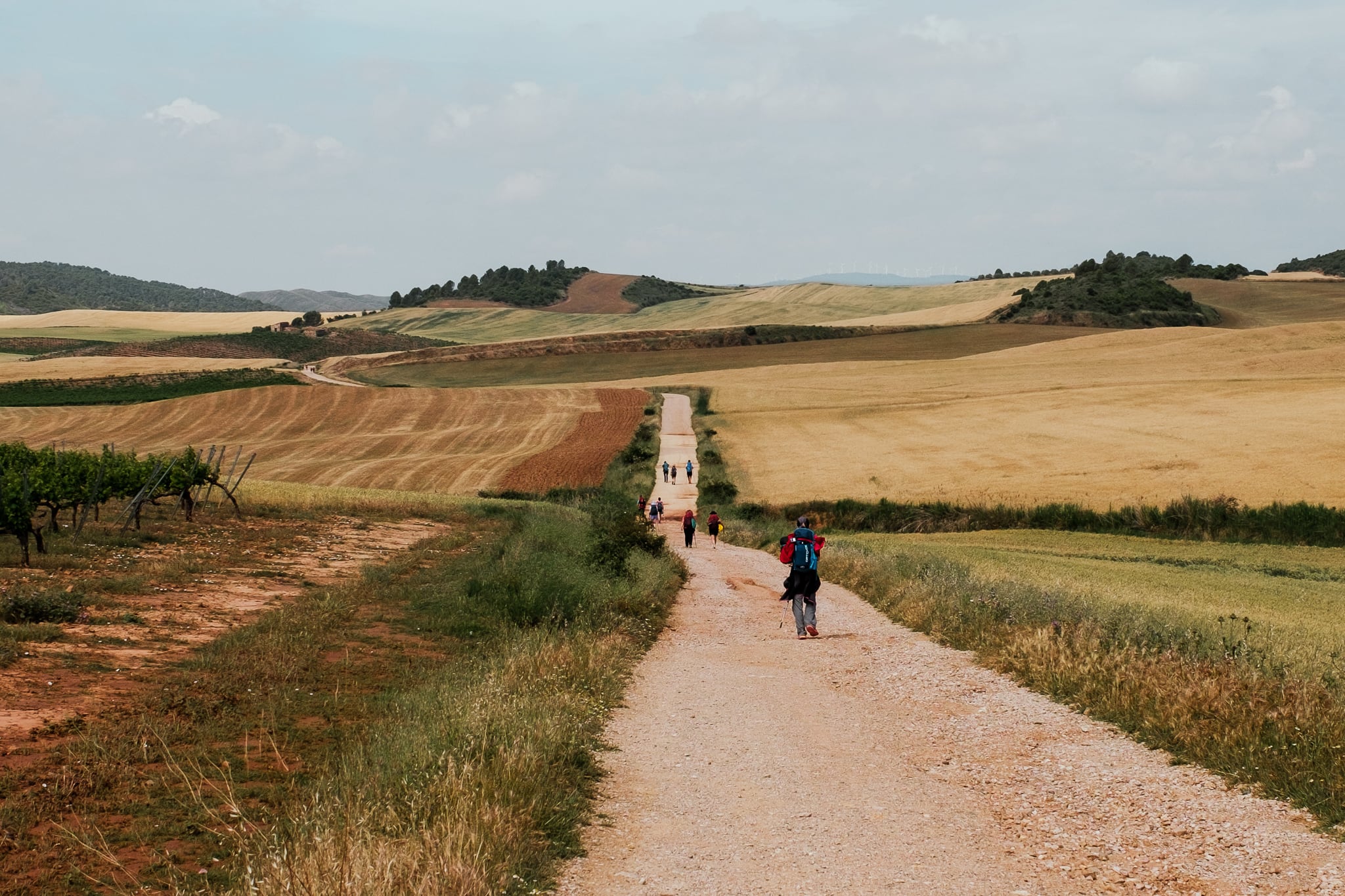
After Villamayor, there is a long but beautiful stretch (more than 12 kilometers) with no services and almost no shade. Make sure you are stocked up with food and water.
Where I Stayed
Casa de la Abuela
Casa de la Abuela was okay — not especially memorable one way or the other. The communal meal was simple but tasty.
Day 7: Los Arcos to Logroño
Distance
28 kilometers
17.4 miles
DIFFICULTY
2/3
industrial areas
Begin early, because this is a long day of walking. (I set out at 5:30 am.)
The first few miles are a flat stretch through fields before you arrive at the picturesque hilltop towns of Sansol and Torres del Rio in quick succession. Be sure to look behind you for good views as you leave Torres del Rio.
After Torres is a long, remote stretch before you reach the lively town of Viana. Enjoy this place, because the rest of the way to Logroño is a long slog with lots of walking along busy roads and unpleasant stretches through industrial areas. (Logroño itself is lovely, though.)


Where I Stayed
Santiago Apostol
I do not recommend Santiago Apostol; I didn’t like much of anything about this place. Instead, take a look at Albergue Albas or Pensión La Bilbaina.
Day 8: Logroño to Nájera
Distance
30.5 kilometers
19 miles
DIFFICULTY
2/3
long and boring
The way out of Logroño is long, boring, and (while in the city) poorly marked. Be sure to look down, as some of the markers are only visible in plates on the ground. Start as early as you can bear to, because (1) this is one of your longest days of walking and (2) you won’t miss any good scenery in the dark, anyway.
Be sure to stock up on supplies in Logroño because you won’t reach any towns until Navarette, about 12 kilometers into this day.
After the second town, Ventosa, there is some nice vineyard scenery. Otherwise, this day involves a lot of walking close to roads and through industrial areas. Truth be told, this was one of my least favorite days of the Camino Frances. The path is long (though otherwise fairly easy) and has only okay scenery.

Where I Stayed
Puerta de Nájera
I liked Puerta de Nájera — the bedrooms are large and the bathrooms small, but it’s a beautiful building.
Day 9: Nájera to Santo Domingo de la Calzada
Distance
21.7 kilometers
13.5 miles
DIFFICULTY
1/3
remote walking
Stock up on supplies in Nájera, because this is a remote day with limited services.
This day begins with a hill right out of Nájera. Red clay is all around, and lots of vineyards follow. After the first (and essentially only) town, Azofra, the surroundings transition to more flat wheat fields.
Shortly before the other town of the day, Cirueña, is a big hill. When I walked in June 2023, a very welcome snack stand was located at the top of this hill, near a shaded area. (I would not expect the snack stand to be there at all times of the year, though.)
Cirueña is one of the stranger sights on the Camino Frances, as it is essentially a modern ghost town. Developers built dozens (hundreds?) of homes and apartment buildings there, which are nearly all empty today following the economic collapse of 2008. (I’m not sure they were ever occupied in the first place!) There must be potential housing for thousands or even tens of thousands of people, but just a few hundred people live there today. Bizarrely, however, the golf course in Cirueña is thriving. Do not expect to find any open cafes or restaurants in Cirueña.
After Cirueña is a beautiful stretch of walking with wide, straight paths carrying a steady stream of pilgrims through green and golden fields.
Santo Domingo de la Calzada is a lovely little town. Whatever you do, do not miss its cathedral, which is the honest-to-god home to several chickens. (The sound of a rooster crowing within a cathedral is hard to forget!)

Where I Stayed
Cofradía del Santo
Cofradía del Santo was fine. For a (fairly) low price, it’s clean and reasonably comfortable.
Day 10: Santo Domingo de la Calzada to Belorado
Distance
22.9 kilometers
14.2 miles
DIFFICULTY
1/3
busy roads
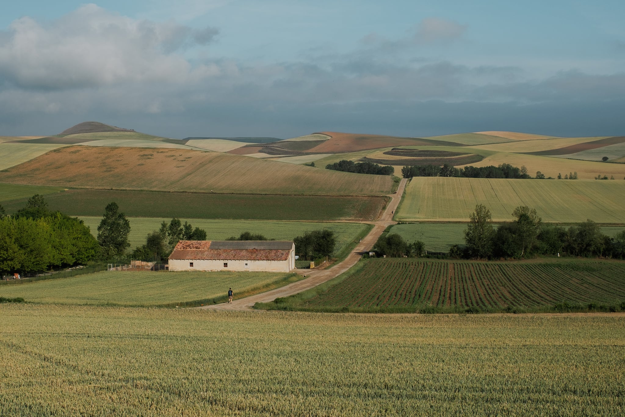
Much of this day requires you to walk beside busy roads, though there is a lovely and more remote section after Grañon. Otherwise, the scenery is filled with small towns and vast fields.
If you are a fan of the movie “The Way,” keep an eye out for the tiles with handprints and footprints from Martin Sheen and Emilio Estevez in Belorado. Belorado is also notable for its many murals.

Where I Stayed
Cuatro Cantones
Cuatro Cantones was delightful. The backyard (which has a pool!) was a very relaxing place to spend the afternoon, and dinner was delicious.
Day 11: Belorado to Agés
Distance
27.7 kilometers
17.2 miles
DIFFICULTY
2/3
long hill
Much of this day involves steady inclines through quiet small towns, mostly away from roads.
Stock up on supplies in Villafranca Montes de Oca, because there is a 12-kilometer stretch between there and San Juan de Ortega with no towns. (There may be a food truck along the way, though, as there was when I walked.) Additionally, be careful in Villafranca; you will need to cross the road, but cards and huge trucks come barreling through at full speed.
There is a large and sometimes steep hill after Villafranca, but it is a lovely walk through the woods. You will eventually reach a civil war monument, after which there is a bit more (dramatic) incline, and then a long and mostly gentle decline. The remainder of the day, for the most part, is a wide path between trees.


Where I Stayed
Monasterio de San Juan de Ortega
I stayed in San Juan de Ortega, the last town before Agés, which I regretted. There are very few beds available in San Juan, and most of them are in the monastery, where I stayed and which I do not recommend. (The remaining beds in town are highly likely to sell out in advance.) I wish I had stayed in Agés instead! The walk between San Juan de Ortega and Agés is easy, and Agés seemed to be a nice little town when I walked through it the next morning. For lodging in Agés, take a look at El Pajar de Agés or La Taberna.
Day 12: Agés to Burgos
Distance
22.3 kilometers
13.9 miles
DIFFICULTY
1/3
industrial areas
This is an easy if somewhat boring day of walking. Aside from one notable incline (and resulting decline) outside of Atapuerca, the way is quite flat.
Note that the path into Burgos is notoriously and unpleasantly industrial. (Friends who walked the primary path described it as “dire” and “horrible.”) Accordingly, many pilgrims choose to take alternate routes. There is one, through Castañares, that is still somewhat industrial but is an improvement over the main path. I went for a partially unmarked path along the river, which was not especially interesting but largely avoided the industrial mire. If you carry a guidebook, it should advise you as to what to do here (here’s mine). At rest stops leading up to Burgos, your fellow pilgrims will also inevitably be discussing this dilemma and you can likely find someone to tag along with if you’re not sure what to do.

Where I Stayed
Happy Hostel Carrales
I took a rest day in Burgos, so I stayed for two nights in a private room at Happy Hostel Carrales. This was an excellent, clean spot and a great place to rest.
Day 13: Burgos to Hornillos del Camino
Distance
22 kilometers
13.7 miles
DIFFICULTY
1/3
urban walking
This is an easy day, marked by a lengthy exit from Burgos and little shade otherwise. I recommend stocking up on supplies in Burgos, because your next opportunity to get food will be 11 kilometers away, in Tardajos.
The descent into Hornillos del Camino is steep and quite picturesque. Hornillos itself is an interesting (and tiny) place to explore because of its many bodegas — little caves used for food storage and wine making. You will see more bodegas in the next few days on the Camino!


Where I Stayed
Hornillos Meeting Point
Hornillos Meeting Point was quite nice. The communal dinner was especially notable for involving the largest pot of paella I had ever seen.
Day 14: Hornillos del Camino to Castrojeriz
Distance
21.4 kilometers
13.3 miles
DIFFICULTY
1/3
remote areas
This is hands down one of the most beautiful days on the Camino Frances!
Your day will begin with a quiet and remote walk out of Hornillos del Camino. I left very early in the morning and saw barely any pilgrims or any other signs of human life for miles. Just me, the windmills, and the poppies.
After several miles, you will reach the town of Hontanas, which was a delightful surprise for me. It seems to appear out of nowhere, as it’s located down in a valley and you must descend to reach it. It’s a very charming little town.
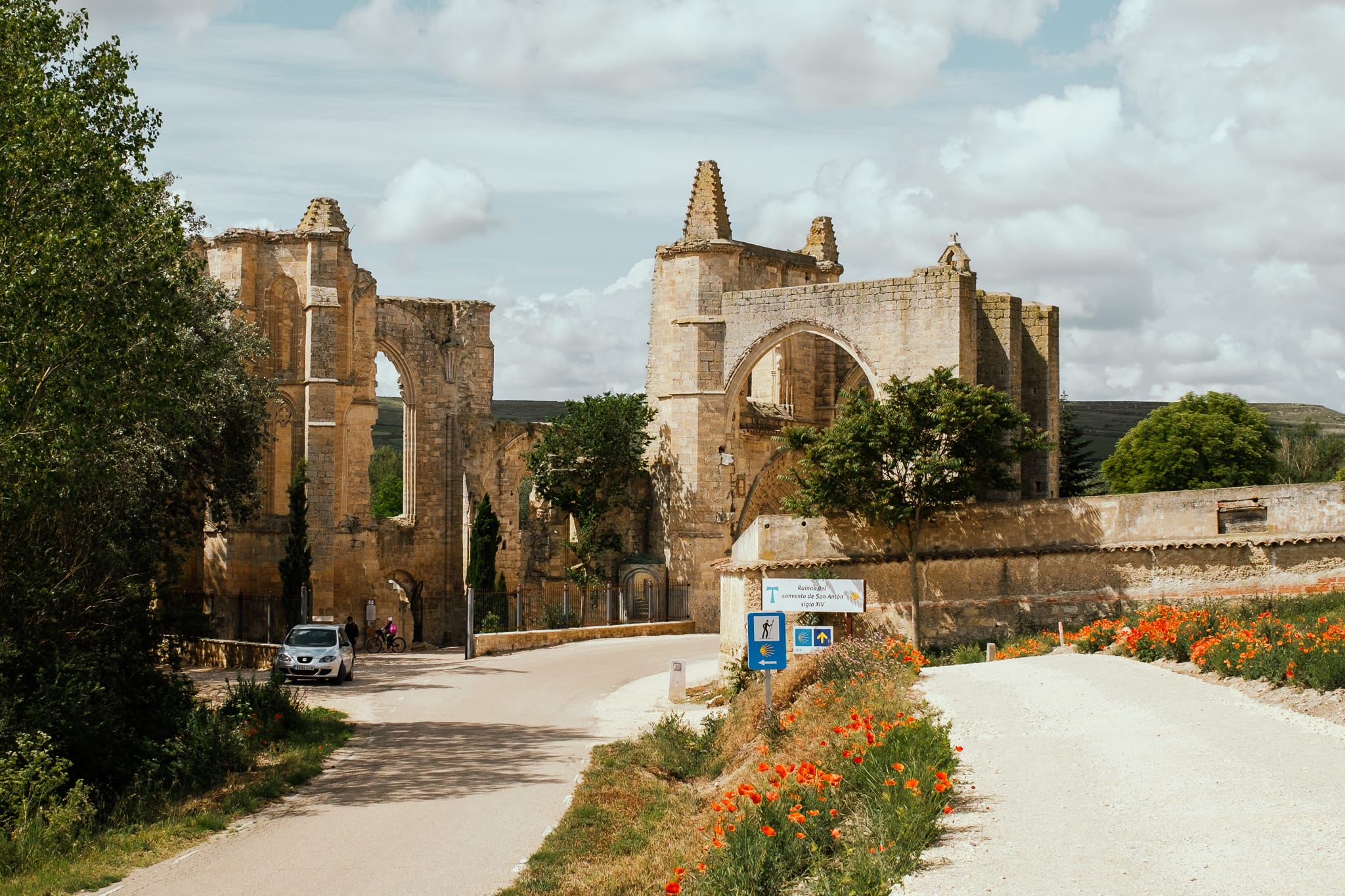
Several more beautiful miles of walking follow, and then you will reach one of the best sights on the Camino Frances: the ruins of the convent of San Antón. This convent was founded in the 12th century by monks who were dedicated to caring for pilgrims. The ruins actually straddle the Camino itself and are incredibly picturesque.
NOTE: If you’re feeling a little adventurous, you can even spend the night at San Antón! There’s a small albergue with a limited number of beds for pilgrims — and no electricity or hot water. Several of my Camino friends stayed there and had wonderful experiences. One of them had a quality camera with him, and got some spectacular astrophotography at night.
From San Antón, you have just a few kilometers to Castrojeriz and its hilltop castle ruins. Notably, you can take a slight detour and exit the ruins the back way. This will take you on an alternate route to Castrojeriz, through beautiful fields and the tiny town of Villaquirán de la Puebla. This adds a bit of distance to your day, but it’s quite lovely — some friends and I took this route and had a wonderful time.
Where I Stayed
Albergue Orion
Albergue Orion was very good. However, I also recommend that you look into Albergue Ultreia, or at least consider joining their communal dinner if they have room. Several of my friends stayed at Ultreia, and I joined them for dinner — which was wonderful. The dining room contains a huge wine press, and the owner gave us a demonstration after we ate (enlisting several pilgrims to help). We also got a tour of the very cool wine cellar!
Day 15: Castrojeriz to Frómista
Distance
26.7 kilometers
16.6 miles
DIFFICULTY
2/3
steep hill
This day begins with a short but incredibly steep hill just outside of Castrojeriz. (Leave early and look back to see the sunrise!) The hill is even steeper descending on the other side, and the view of the flat Meseta (the Spanish plains you are entering here) is beautiful.
There is a long stretch with few services before Itero de la Vega; stock up in Castrojeriz.
The Meseta is not known for shade (which you will really start to learn on this day), but you will find some in the last stretch before Frómista, where you will walk beside a canal. There is a canal lock just before town.

Where I Stayed
Estrella del Camino
Estrella del Camino was good. There were quite a few beds in one room, but it was surprisingly quiet and comfortable nonetheless.
Day 16: Frómista to Carrión de los Condes
Distance
20.4 kilometers
12.7 miles
DIFFICULTY
1/3
road walking
The main event of this day is a fork in the road just after the first town, Población. Go left to stay along the road, or go right for a slightly longer but more scenic path along the river. Do not take the scenic road if it’s raining. I went this way the day after a storm and it was still extremely muddy and, at times, difficult to walk (not to mention blocked by broken tree branches, etc.).
After the routes meet again, the last stretch is a long, straight slog beside the road (a theme of the Meseta).
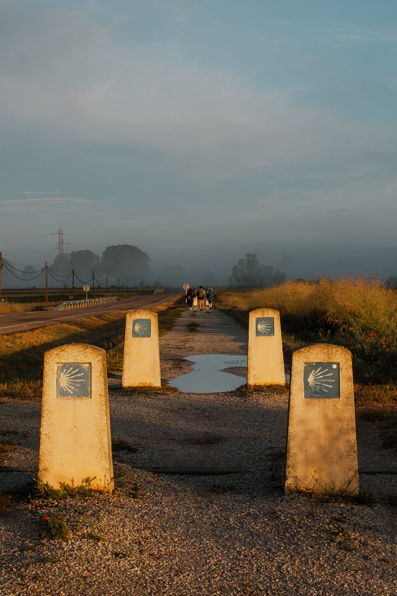

Where I Stayed
Santa Maria
Santa Maria was inexpensive and basic (but fine). This albergue is run by nuns, who hold a daily sing-a-long for pilgrims in the lobby. You can attend this event (which I strongly recommend!) even if you do not stay in the albergue.
Day 17: Carrión de los Condes to Terradillos de los Templarios
Distance
26.3 kilometers
16.3 miles
DIFFICULTY
1/3
remote areas
The first part of this day is the longest stretch between towns on the entire Camino Frances: a whopping 17 kilometers. Be sure to stock up on food and water the day before in Carrión de los Condes! However, depending on when you are walking, there may be a (wonderful) food truck about 5 miles in.
Be aware that using the bathroom is also a notable challenge during this stretch. The path is long, straight, and flat, with few bushes and trees along most of it. Unless you walk exceptionally early, there is also a steady stream of pilgrims the entire way.
After you reach the town of Calzadilla, the rest of the day is largely along the road.

Where I Stayed
Los Templarios
Los Templarios is a large albergue just outside the town of Terradillos. This was a nice place to hang out for the afternoon, and the rooms were fairly small, which is a positive thing on the Camino (mine had just four bunks!).
Day 18: Terradillos de los Templarios to Bercianos del Real Camino
Distance
24.5 kilometers
15.2 miles
DIFFICULTY
1/3
road walking
The first few miles out of Terradillos are beautiful, winding, and remote. After San Nicolás del Real Camino, the path mainly follows the road.
Sahagún, which you will reach partway through the day, is notable for containing the geographic center of the Camino Frances. If you like, you can get a midpoint certificate at Santuario de la Virgen Peregrina to mark this achievement.
Several miles after Sahagún, you will face one of the Camino’s most notable forks and must choose whether to go south to Bercianos del Real Camino along the Real Francesca route or north to Calzadilla de los Hermanillos along the Via Trajana route (the routes do not reunite until the following day).
The southern Real Francesca route follows the road, but the path is gravel and has ample shade. The road is also fairly remote, so there aren’t actually many cars; it is a quiet and easy but boring path.
The northern Via Trajana Route follows a Roman road and is more remote. It also contains a very long stretch without any services. I am told that this route is more beautiful, but that the path is rocky (which can be unpleasant under tired feet).
I chose the southern route to Bercianos.

Where I Stayed
Bercianos 1900
Bercianos 1900 was very nice. The room was great for sleeping, as each bunk had a curtain, and the restaurant and bar downstairs was lovely.
Day 19: Bercianos del Real Camino to Reliegos
Distance
20.8 kilometers
12.9 miles
DIFFICULTY
1/3
boring
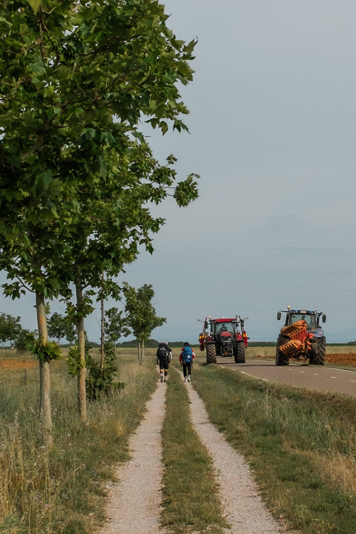
This is an easy but boring day of walking on a gravel path beside the road.
I recommend stocking up on supplies in El Burgo Ranero, as there is a 13 kilometer stretch between towns after that. There are several rest areas for pilgrims along the way to Reliegos, so packing food and water is a good idea.
NOTE: I originally planned to stay at the next town, Mansilla de las Mulas, but I heard through the pilgrim grapevine that the municipal albergue there was temporarily closed and I did not have a reservation anywhere else. Concerned about a potential shortage of beds in Mansilla, I stopped in Reliegos instead. You might consider walking onward to Mansilla, which would make the following day of walking several miles shorter (giving you more time to explore León when you arrive).

Where I Stayed
Don Gaiferos
I stayed at the Don Gaiferos municipal albergue, which was sparse but fine, and inexpensive.
If you stay in Reliegos, do not miss Bar Elvis, which is one of the most unique places I encountered on the Camino.
Day 20: Reliegos to León
Distance
25.4 kilometers
15.8 miles
DIFFICULTY
1/3
industrial areas
The first part of this day involves more walking on a gravel path beside the road. Shortly after Mansilla de las Mulas, you can take a detour to Sandoval monastery, which adds about 5 kilometers. There is a briefer detour option at Villamoros, where you can add 0.3 kilometers to take a safer route away from the busy road.
In the second half of the day, the path enters the industrial outskirts of León. This is one of the most unpleasant stretches of the entire Camino Frances, passing by many car dealerships, strip malls, and warehouses, and crossing multiple highways. The day ends with plenty of urban walking into the center of León.

Where I Stayed
Hostel Quartier León Jabalquinto
Hostel Quartier León Jabalquinto was nice, but not a place I recommend for pilgrims. That’s because it’s not limited to pilgrims, and some of my dormmates did not respect the curfew, turning on lights and talking loudly in the middle of the night. Instead, stay at an albergue for pilgrims only, such as Albergue Peregrinos San Francisco de Asis or Santo Tomas de Canterbury.
Day 21: León to Villar de Mazarife
Distance
22 kilometers
13.7 miles
DIFFICULTY
1/3
urban walking
The exit from León is nearly as tedious as the entrance was, with a long stretch of urban, suburban, and industrial walking.
Right after Virgen del Camino, there is a fork in the road. Go left for a longer but more scenic route, and right for a shorter but less beautiful route. The routes will not join up again until the following day, so this choice determines where you spend the night.
I went left, on the scenic route. (For what it’s worth, I later ran into a friend who took the shorter path and she said it was “bad.”) This route is nice, with a couple of tiny towns and some gently rolling hills. The final stretch into Villar de Mazarife is extremely flat.

Where I Stayed
Tío Pepe
Tío Pepe was fine. The rooms were small, which was nice — mine had four bunks and just one other occupant. However, you might consider staying at San Antonio de Padua instead. Two of my friends stayed there, and I joined them for the communal dinner, which was absolutely wonderful.
Day 22: Villar de Mazarife to Astorga
Distance
31.5 kilometers
19.6 miles
DIFFICULTY
2/3
long ascent
Say goodbye to the flat, boring Meseta scenery today — but first, one last straight slog through fields. Mercifully, all that comes to an end in Hospital de Órbigo, where you will also find the longest bridge on the Camino (it has 20 arches!).
As you exit Hospital, you’ll face yet another fork in the road. Go straight for the shorter path along the road, or right for a slightly longer path away from the road. (I went right.) In June 2023, the signage was not great here, but look to see if there are arrows painted on the road with some directions.
Soon after Hospital begins a long but gradual ascent, signaling the end of the flat Meseta. You will soon reach one of the Camino’s best and biggest donativo stands (complete with couches and hammocks). Finally, there is a cross with a wonderful view of Astorga, then a steep but brief descent into the city.

Where I Stayed
Astorga Suites
Staying at Astorga Suites was a bit of a splurge, as Camino spending goes, but I was taking a rest day in Astorga and opted for this private apartment. It was so lovely! And the view of Gaudí’s Palace was wonderful.
Day 23: Astorga to Foncebadón
Distance
26 kilometers
16.1 miles
DIFFICULTY
2/3
steep ascent
This day will take you back to the mountains, which are a welcome change after the flat Meseta. Throughout the day, there is a slow and steady climb with a fairly gradual ascent. However, as you approach Rabanal, there is a rocky stretch through the woods.
Then, after Rabanal, the climb becomes much steeper the rest of the way to Foncebadón (about 3 miles).


Where I Stayed
Monte Irago
Monte Irago was good. The communal dinner was a highlight, with group singing and sharing.
Day 24: Foncebadón to Ponferrada
Distance
27.2 kilometers
16.9 miles
DIFFICULTY
3/3
long, steep descent
This day begins with a fairly brief climb up to Cruz de Ferro, a famous iron cross perched high on top of a wooden post. Cruz de Ferro is one of the best-known monuments on the Camino. Traditionally, pilgrims carry stones or other symbols along the way and lay them down at Cruz de Ferro.
After Cruz de Ferro, you will begin the long, long, looooooong walk down to Molinaseca.
This is, in my view, the most difficult downhill portion of the Camino Frances (and it’s not a close competition). Be kind to your knees and go slowly. Some people choose to walk parts of this day on the road rather than the trail (when possible) in order to avoid the rocks. The sweet little town of El Acebo is a highlight along the way (I had a memorable slice of lemon cake at the first cafe in town).
The reward of this challenging hike down is Molinaseca, which is a completely gorgeous little place. Take a nice long rest here, and fuel up before tackling the final few miles to Ponferrada (miles that are pretty much entirely on a sidewalk beside a busy road).
NOTE: If you think the descent from Cruz de Ferro will be difficult for you, and you would rather stay in Molinaseca instead of continuing on to Ponferrada, either the following day (Molinaseca to Villafranca del Bierzo) will be quite long (nearly 32 kilometers), or you will need to rearrange the next several days of your Camino pretty substantially compared to my own itinerary (which is a perfectly fine choice, if so!). I recommend the following plan:
Day 24: Foncebadón to Molinaseca (19.5 kilometers / 12.1 miles)
Day 25: Molinaseca to Cacabelos (24.1 kilometers / 15 miles)
Day 26: Cacabelos to Trabadelo (17.7 kilometers / 11 miles)
Day 27: Trabadelo to O Cebreiro (18.7 kilometers / 11.6 miles)
Day 28: O Cebreiro to Triacastela (20.7 kilometers / 12.9 miles)
Day 29: Triacastela to Sarria (18.7 kilometers / 11.6 miles)
If you want to wait and see how your knees do on the descent before deciding whether to stay in Molinaseca or Ponferrada, I strongly recommend that you do not book ahead for any lodging on Days 24 through 28 (both versions of my itinerary will have you landing in Sarria on Day 29).

Day 25: Ponferrada to Villafranca del Bierzo
Distance
24.3 kilometers
15.1 miles
DIFFICULTY
2/3
road walking
The first few miles of this day are just the exit from urban Ponferrada, swiftly followed by a long stretch of walking directly on a road (which, thankfully, is not terribly busy). In general, this is a day with many, many cars — in addition to some stretches on the road, there are many miles logged on sidewalks right next to roads.
However, near the end of the day, the path veers away from the main road and onto a dirt and gravel road through vineyards. There are some difficult and steep bits here, but this is easily the most beautiful part of the day.

Where I Stayed
Viña Femita
Viña Femita was one of my favorite albergues on the entire Camino Frances! It’s a beautiful building with a huge, shaded patio. The dorm room is gorgeous and there are no bunk beds (a rare and special thing on the Camino). Plus, the dinner was great and the hosts were so lovely. I strongly recommend this place!
Day 26: Villafranca del Bierzo to La Faba
Distance
23.7 kilometers
14.7 miles
DIFFICULTY
3/3
steep ascent
As you leave Villafranca del Bierzo in the morning, you’ll quickly be faced with a choice: stay on the main path, for flat walking on the shoulder of a road (protected by a crash barrier), or veer off onto the “Camino Duro” path, which carries you high up above the highways. The Camino Duro is much, much more difficult, and adds a bit of distance. (Camino friends who took the Camino Duro said it was the most difficult stretch of the Camino — even more difficult than the Pyrenees.) I stayed on the main path and avoided the Camino Duro.
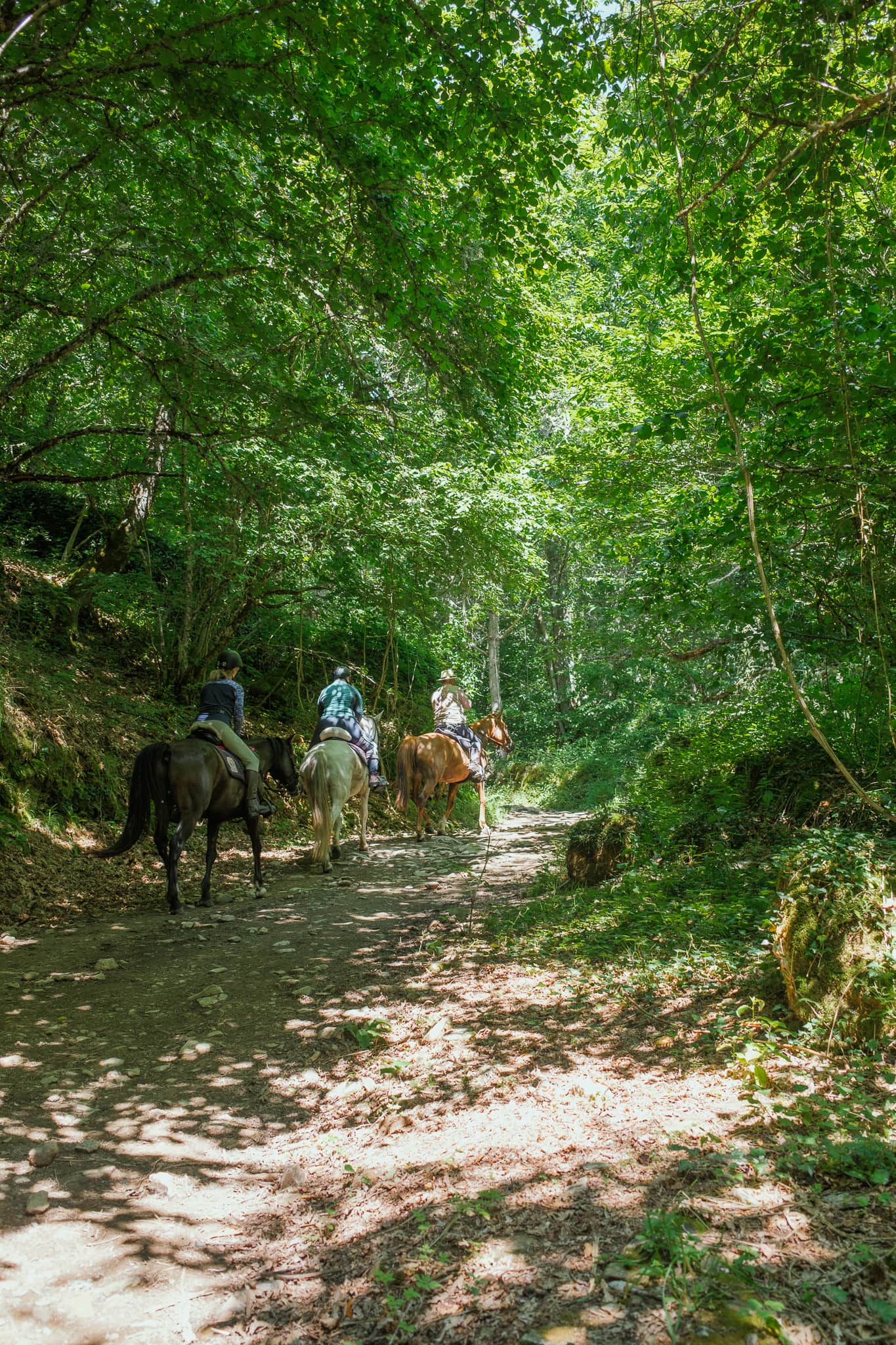
The final part of this day will have you begin the climb up to O Cebreiro. Most pilgrims agree that the climb to O Cebreiro is the second-hardest ascent of the Camino Frances (after the Pyrenees on Day 1). Some people tackle the whole thing in one day, but I happily broke it up by stopping in La Faba for the night. Much of the last few miles to La Faba is quite steep, but it is also in the woods and shaded, which is helpful. Be aware that many people ride horses up this mountain, so the trails may be covered in, uh, evidence of that.

Day 27: La Faba to Triacastela
Distance
25.8 kilometers
16.1 miles
DIFFICULTY
3/3
steep sections
Wake up early and begin the beautiful ascent to O Cebreiro. If the weather is good, you can expect unbelievable views of the sun rising over the mountains as you climb. The path is intermittently steep, but is generally a reasonably gradual ascent.
After O Cebreiro, the path goes up and down for a while with some steep stretches. There is one incredibly steep section of climbing to Alto do Poio.
On days with good weather, the descent to Triacastela is very beautiful (particularly after Biduedo), with gorgeous views. The descent is also mostly gradual and easy, with some wooded sections.

Day 28: Triacastela to Samos
Distance
10.4 kilometers
6.5 miles
DIFFICULTY
1/3
road walking
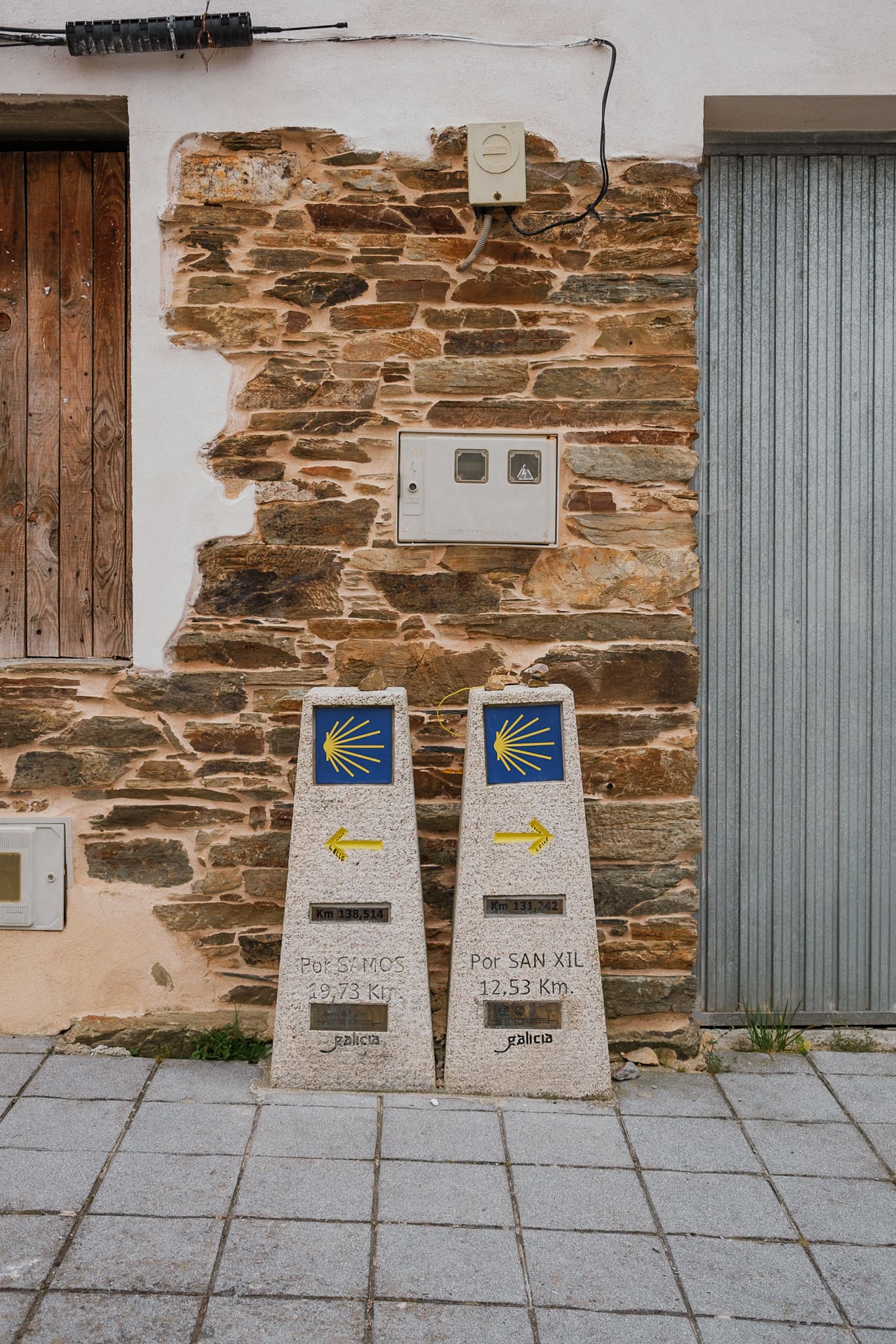
The way out of Triacastela involves a fork in the road: either turn right, toward San Xil, or left, toward Samos. Both routes will take you to Sarria in one or two days, depending on your choices.
The way through San Xil is shorter, but otherwise a bit more difficult. The way through Samos is longer, otherwise easier, and purportedly prettier, and it allows you to visit the Monastery of San Xulián in Samos.
I chose to go through Samos, which I do recommend if you have any interest in the monastery.
Because this is such a short day of walking, I actually extended it a bit by taking a 100% out-of-the-way detour to the art gallery of Arthur Manton Lowe. Art is a wonderful artist who lives in Spain part of the year in a gorgeous little home/gallery that’s right on the Camino, on the path to San Xil. (I mean RIGHT ON the Camino.)
Art is an incredible person and sells beautiful art inspired by the Camino and other places he has visited. If you purchase some art from him, he may even paint a custom watercolor “stamp” in your credencial!
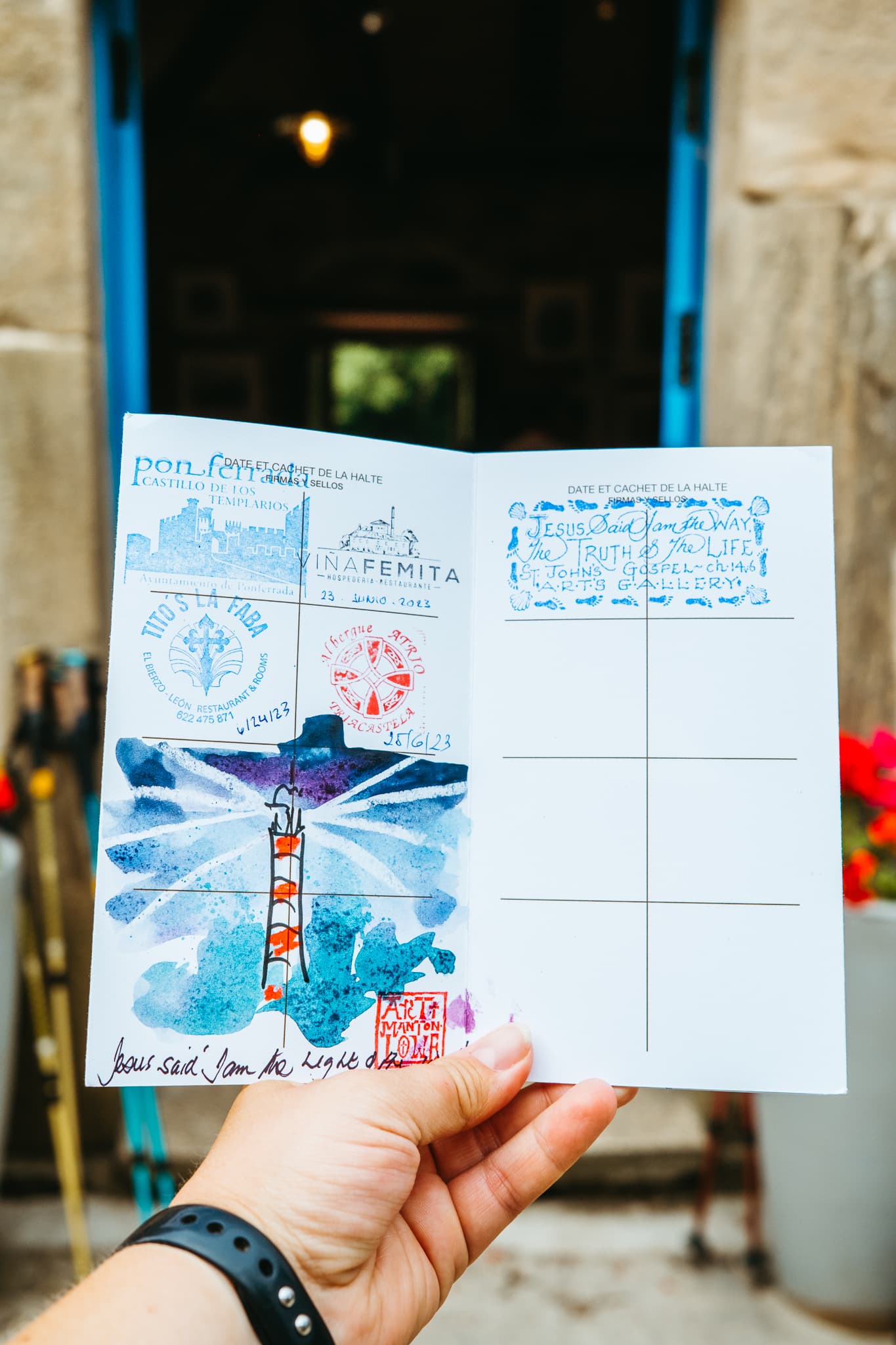
If you’d like to visit Art’s gallery, but otherwise plan to head to Samos, I recommend reaching out to him on Instagram first to make sure he will be home the day you plan to visit.
After visiting Art, turn around and head back to Triacastela, then go the opposite way at the fork — toward Samos this time. Be sure to carry plenty of food and water with you, because there is one bar along the way that may or may not be open, and that is likely it.
NOTE: If you have only 33 days to walk, skip the overnight in Samos and walk on to Sarria this day. Alternatively, you can take the shorter (but more difficult, and purportedly less beautiful) route from Triacastela to Sarria through San Xil (18.7 kilometers, or 11.6 miles).

Where I Stayed
Monasterio de San Xulian de Samos
I stayed at the monastery in Samos, which was an interesting experience. It was very sparse, but inexpensive and clean. If you can manage it, I think it’s nice to stay at several (or more) basic places like this during the Camino. Staying at the monastery also made it easy to (1) tour the monastery, which you can only do at certain times of day during a guided tour, and (2) attend the evening vespers service.
Note that the Samos monastery is a donativo, meaning that you pay what you choose.
Day 29: Samos to Sarria
Distance
14.6 kilometers
9.1 miles
DIFFICULTY
1/3
urban walking
This is an easy breezy, short day of walking.
The first few miles of this day follow the road, but the trail soon enters the woods with some gorgeous, storybook stretches through a forest. There are a few hilly sections, but it is generally easy. Eventually, the path joins up with the alternate route, and then the remainder of the way is primarily along a road until you enter Sarria and do a bit of urban walking.
Stock up on supplies in Samos, because you may not find any open cafes until shortly before Sarria.


Where I Stayed
Aqua Rooms
My mother and sister actually joined me in Sarria to walk the rest of the Camino with me! So, I took a rest day in Sarria while I waited for them, and we stayed at Aqua Rooms, which was quite nice.
Day 30: Sarria to Portomarín
Distance
22.6 kilometers
14.1 miles
DIFFICULTY
1/3
steep descent
This is nice day of walking with woods and a steep hill as you exit Sarria, followed by some gorgeous views of the mountains all around. There are some small towns with services, some vending machines, and some donativo tables (tables with things for pilgrims to take; they operate on the honor system/by donation).
For many pilgrims who didn’t start in Sarria, the highlight of the day is reaching the distance marker indicating that you have exactly 100 kilometers until you reach Santiago de Compostela. Shortly before the 100km marker, there is a cafe that serves excellent yogurt.
As you approach Portomarín, there is a fork in the road. The original route and alternate route are the same length, but the original includes a steep descent through what is essentially a gorge. The alternate route also has a steep descent, but down a road. (We chose the alternate route.)
You will cross a famous (high, long) bridge to enter Portomarín. Keep an eye out for ruins along the sides of the river (or within the river if the water level is low); the town was actually relocated up the hill in the mid 20th century after a dam flooded the former city.


Where I Stayed
Ultreia
My mom, sister, and I stayed in a private room (with three beds) at Ultreia. It was okay! We had access to a shared bathroom with two showers and two toilets, though we never saw anyone else in there. There was a large sink for handwashing our clothes, and a laundry line with plenty of space. I believe there were also kitchen facilities, although we did not use them.
Day 31: Portomarín to Palas de Rei
Distance
25.8 kilometers
16 miles
DIFFICULTY
2/3
hilly
This day begins with another fork in the road — as you’re leaving Portomarín, you must choose whether to go left or right. If you’re reaching this point anywhere near sunrise, I recommend going left (as we did) for a chance to get wonderful sunrise views over the river and the bridge. There is a steep climb out of town, but look behind you for those views as you get some elevation.
Be aware that the first stretch of walking is a long way (8 kilometers) without a town, but there are many small towns (which may or may not have services) the rest of the day. This is a hilly day, with a steady climb upward in the first half of the day (sometimes steep, often gradual), and then lots of ups and downs throughout the second half of the day. The way into Palas de Rei is downhill.
Keep an eye out for the small chapel in Ventas de Narón, where a blind man stamps credenciales.

Where I Stayed
Albergue Mesón de Benito
We stayed in a dorm room at Albergue Mesón de Benito. The room was spacious, and not full, which we appreciated, although we did have the misfortune of sleeping directly below a room full of teenagers walking the Camino with some sort of documentary project. They did not respect the albergue’s quiet hours, although my earplugs were mercifully effective. Also, while this albergue was a perfectly fine place to stay, I recommend that you avoid their mixed drinks; the bar served the worst tinto de verano I had on the entire Camino.
Day 32: Palas de Rei to Ribadiso da Baixo
Distance
25.8 kilometers
16 miles
DIFFICULTY
2/3
ups and downs
The first part of this day has some ascents and descents, but nothing too strenuous. There are lots of stretches through pretty woods, and a brief section in an industrial area.
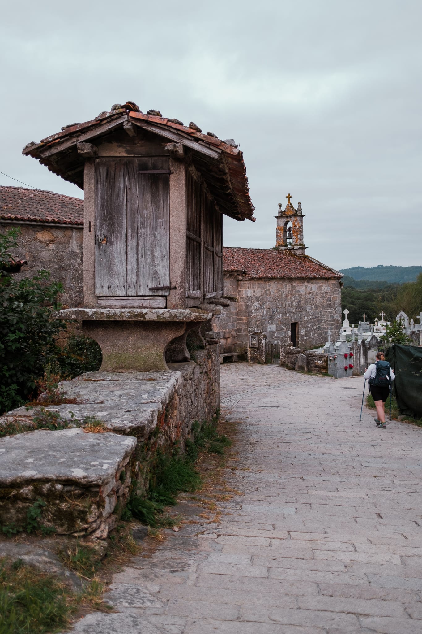
You can’t miss the beautiful bridge entering Furelos, or the large hill into Castañeda. The last section of walking includes constant ups and downs between Boente and Ribadiso. Keep an eye (and nose) out for the eucalyptus groves!
We actually did not stay in Ribadiso da Baixo, because we had pre-booked lodging in Arzúa — the next town ahead. As we walked through Ribadiso, exhausted and ready to be done for the day, we very much wished that we could stop there. It looked very cute and relaxing, with a beautiful river! (Staying in Ribadiso would have also split up our mileage in a better way.) So, I recommend that pilgrims stay in Ribadiso rather than planning to forge ahead to Arzúa (which we found unimpressive, by the way).

Where I Stayed
Pension Domus Gallery
We stayed at Pension Domus Gallery in Arzúa. This was a very nice pension, and our room even had air conditioning, which was quite welcome after our 30-kilometer day of walking. However, for the reasons discussed above, I recommend that you stay in Ribadiso rather than Arzúa. Check out Gronze.com for lodging options in Ribadiso.
Day 33: Ribadiso da Baixo to O Pedrouzo
Distance
22.2 kilometers
13.8 miles
DIFFICULTY
2/3
urban walking
This day begins with a large hill exiting Ribadiso, and then a decent stretch of urban walking through Arzúa. After you leave Arzúa, there are lots of wooded stretches, and a fair number of gradual ups and downs. There are also lots of small towns and services, and more eucalyptus. The trail is often shaded, which is quite welcome.
Be aware that if you are staying in O Pedrouzo, as I recommend, you need to turn left to enter O Pedrouzo. (The path continues to the right on a shortcut for those not staying in O Pedrouzo.)


Where I Stayed
Albergue Mirador
We stayed in a private room at Albergue Mirador in O Pedrouzo. We loved this place for its wonderful pool, where we spent the whole afternoon.
Day 34: O Pedrouzo to Santiago de Compostela
Distance
20 kilometers
12.5 miles
DIFFICULTY
1/3
large hill
I recommend leaving early this day in order to reach Santiago with plenty of time to attend pilgrims’ mass at noon. (Even if you aren’t interested in the service, it’s worth attending just for the chance that you might get to see them swing the botafumeiro!) We started walking before 6 am.
The first stretch of walking is through the woods and is quite dark; be sure to use a head lamp if you are leaving early. There is a large hill a few miles in. Be ready for planes at the top of the hill; the airport is quite nearby and you might grab great photos or videos of planes flying just overhead.
There is some walking directly beside the highway for a bit and then you will go through some small towns.
At Monte de Gozo, you can take a detour to see a statue of giant pilgrims pointing the way. (We opted against this.) Either way, keep a sharp eye out, because this is where you can get your first glimpse of the cathedral towers in the distance in Santiago.
The last few miles are urban walking through the streets of Santiago. You will see many other pilgrims, possibly arriving from multiple Camino routes. Your Camino concludes in the large square in front of the cathedral, where you will find plenty of people celebrating and taking photos.


Where I Stayed
Aldara Suites
We stayed in Aldara Suites in Santiago de Compostela. It was nice to wash our clothes in a laundry machine, and the suite was small but newly updated. This was a great place to finish our Camino!
Final Thoughts
If you have approximately 34 days to walk the Camino Frances, this is a great itinerary for you to use.
But remember: walk your own Camino! Follow the itinerary that works for you. And, if possible, remain flexible and able to change your plans as you go.
Buen Camino!
More Information About the Camino
THE BASICS | Start with an introduction to the Camino de Santiago and 15 important things to know about the Camino, and read about a typical day on the Camino.
SAFETY | Find out what to know about safety on the Camino.
FOOD | From typical meals to costs, here’s everything to know about food on the Camino.
GO IT ALONE | Here’s what you need to know if you’re thinking about walking the Camino alone (like me!).
EXPENSES | Just how much does the Camino cost, anyway? Find out here.
GET READY TO GO | Here’s what to know about how long the Camino takes, how to plan for the Camino (or not!), and 9 helpful ways to prepare for the Camino.
PACKING GUIDE | Everything you need to know about what to pack (and not to pack!) for the Camino, plus a printable packing checklist.
CAMINO FRANCES | If you walk the Frances route, here are 10 incredible things you can expect to see — plus my own Camino photo diary.
SHORT CAMINO | Here’s how to walk the Camino in just 5 days.
PHOTOGRAPHY | A complete guide to taking great photos on the Camino de Santiago.
pin this post




I’m a retired 30 year Marine. For much of 30 years I routinely hiked 25 miles in A day. Retired 2000, still fit. Worked 20 more years. Took a tour with a bunch of other near octogenarians in 25. We traced the Camino Frances, walked a total of about 25 k in 14 days. Smitten with the Camino. I’m 77, 6’2” about 210, think in shape. Have begun walking 6-10 miles three time a week. Think I can make it? I do. Thinking about Sept 26? My 76 year old wife (51 years) thinks I’m nuts. I think I need it.
I LOVE this. Hell yeah you can make it! I met pilgrims who were older than you during my Camino — and honestly, I think every single one of them passed me on the trail 🙂
If possible, I recommend keep your plans open and flexible so that you can walk as much or as little as you want/are able each day and simply go at your own pace.
I think you will love the Camino. Please report back after you make it to Santiago 🙂 Buen Camino!